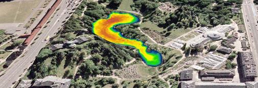
Landscape Analysis & GIS (Glacial Age - Present)

The interplay between the physical landscape and past societies is a requiring theme in archaeological research. Here the analysis of geological composition, landscape analysis based on geographical information systems (GIS) and 3D modelling of fieldwork data can be a valuable tool.
Combining information on geological and anthropogenic sediments can generate a better understanding of how the landscape appeared and was used by humans in the past. Such landscapes influenced past human societies through the local environment, accessibility to and between sites and availability of important local resources. Conversely societies of the past have also influenced how the landscape and the society of today appear in many areas.
GIS in combination with maps, geo-data and survey measurements can be utilised for a variety of different landscape analyses. Such landscape analysis typically utilises historic and modern maps, digital altitude modelling, geological data, environmental data, airplane photography and other sources. The method can identify changes in the distribution of geographical objects through time and space.
3D modelling and visualisation is important elements in any landscape analysis. They are a useful tool in the final phase of understanding and interpreting fieldwork results and may also prove valuable in the initial planning of an archaeological field project. In combination with geological interpretation, a landscape analysis can be a valuable to the spatial understanding of a site.
An analysis of the geological sediments typically consists of a detailed study of strata sequence and content, thus combining soil type identification with an interpretation of each layer’s sedimentation and order of strata. In detailed strata sequencing some of the following topics could be included:
- origin of strata
- continuous depositing or rebidding
- presence of past growing zone in strata
- water impact of strata
- evidence of human activities in the strata
- possible lines of movement in the landscape
The Globe Institute has extensive experience in the geological field of research in Denmark, Sweden, Iceland, Northern Russia and Greenland. ArchaeoScience offers custom made analysis for archaeological projects.
A landscape analysis can advantageously be combined with other types of analysis, such as XRF scanning, macrofossil and pollen analyses, thus offering a more complete understanding of past landscape and environment.
Contact 
Kurt H. Kjær
Professor
Research: Quaternary geology
Mobile: +45 30589730
Email: kurtk@sund.ku.dk
